BIM & Digital Twin Solutions
Integrating BIM, GIS, Drone, IoT, AI, and spatial intelligence technologies to transform physical infrastructure into data-driven digital ecosystems for planning, monitoring, simulation, and operational optimization.
Scan-to-BIM & Assemblies
Transform raw laser datasets into intelligent Revit models
Advanced BIM and Digital Twin solutions designed to support infrastructure digitization, engineering coordination, smart asset management, and enterprise-scale operational intelligence across buildings, utilities, transportation networks, industrial facilities, and smart city ecosystems.
Integrated digital workflows combining BIM modeling, GIS intelligence, drone-based reality capture, IoT connectivity, AI analytics, and 3D visualization enable organizations to improve infrastructure visibility, operational efficiency, predictive maintenance, and lifecycle decision-making.
The ecosystem supports intelligent infrastructure planning, infrastructure monitoring, collaborative engineering environments, spatial coordination, and real-time operational analytics through connected digital platforms and immersive visualization systems.
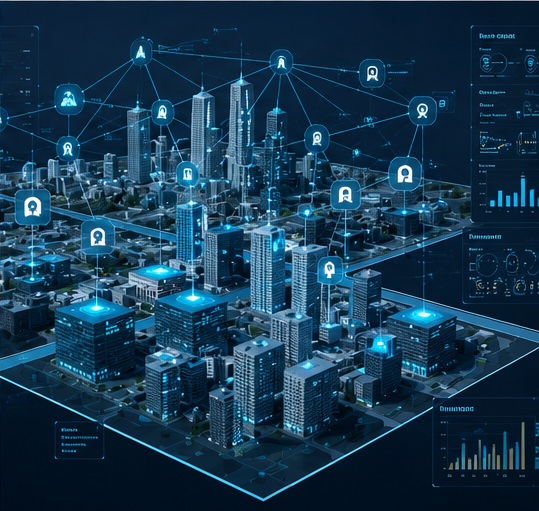
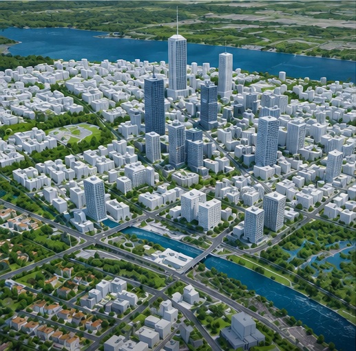
Intelligent BIM, GIS & Digital Infrastructure Ecosystems
Advanced BIM, Digital Twin, GIS integration, and reality capture workflows enabling enterprise-scale infrastructure intelligence, engineering coordination, and operational visibility.
BIM Modeling & Infrastructure Digitization
Intelligent BIM workflows enabling accurate digital representation, engineering visualization, infrastructure coordination, and lifecycle management across buildings and infrastructure ecosystems.
Key Capabilities
- ● BIM Modeling & Coordination
- ● Architectural & Structural Modeling
- ● MEP Modeling
- ● As-Built BIM Development
- ● Infrastructure Digitization
- ● Engineering Design Integration
Digital Twin Development
Integrated Digital Twin ecosystems enabling real-time infrastructure visualization, operational intelligence, connected asset monitoring, and smart infrastructure management workflows.
Key Capabilities
- ● Digital Twin Platform Development
- ● Infrastructure Twin Modeling
- ● Real-Time Asset Visualization
- ● Smart Infrastructure Monitoring
- ● IoT-Integrated Twin Ecosystems
- ● Operational Intelligence Systems
GIS-BIM Integration
Unified GIS and BIM integration workflows connecting spatial intelligence with engineering models to enable centralized infrastructure visibility and enterprise asset management.
Key Capabilities
- ● GIS-BIM Integration
- ● Geo-Referenced BIM Models
- ● Infrastructure Visualization
- ● Spatial Coordination Systems
- ● Integrated Asset Management
- ● Spatial Infrastructure Intelligence
Reality Capture & 3D Reconstruction
Advanced reality capture and spatial reconstruction workflows using drone imagery, LiDAR, photogrammetry, and point cloud processing for accurate 3D environments.
Key Capabilities
- ● Point Cloud Processing
- ● 3D Reconstruction
- ● Drone-to-BIM Workflows
- ● LiDAR Data Processing
- ● Reality Capture Integration
- ● High-Accuracy Spatial Modeling
Smart Infrastructure & Asset Intelligence
Connected infrastructure intelligence systems enabling predictive maintenance, operational analytics, lifecycle monitoring, and real-time infrastructure visibility across enterprise environments.
Key Capabilities
- ● Asset Lifecycle Intelligence
- ● Predictive Maintenance Analytics
- ● Infrastructure Monitoring Systems
- ● Smart Asset Visualization
- ● Operational Intelligence Dashboards
- ● Connected Infrastructure Ecosystems
BIM, Digital Twin & Infrastructure Deliverables
Enterprise-ready BIM assets, Digital Twin systems, spatial intelligence, and engineering-grade deliverables designed for operational visibility, infrastructure coordination, and scalable digital transformation.
Infrastructure & BIM Deliverables
Comprehensive BIM deliverables and engineering coordination systems enabling infrastructure digitization, design accuracy, lifecycle visibility, and centralized infrastructure management.
Key Deliverables
- ● BIM Models & Engineering Coordination Files
- ● As-Built Digital Models
- ● Architectural, Structural & MEP Models
- ● Geo-Referenced BIM Assets
- ● Infrastructure Documentation Systems
Digital Twin & Visualization Deliverables
Interactive Digital Twin environments and real-time visualization systems supporting operational intelligence, infrastructure simulation, and enterprise monitoring workflows.
Key Deliverables
- ● Interactive Digital Twin Platforms
- ● 3D Infrastructure Visualization
- ● Real-Time Monitoring Dashboards
- ● Infrastructure Simulation Environments
- ● Operational Intelligence Dashboards
Spatial & Reality Capture Deliverables
High-accuracy spatial datasets, LiDAR processing outputs, and reality capture deliverables supporting advanced infrastructure visualization and reconstruction workflows.
Key Deliverables
- ● Point Cloud Data
- ● LiDAR Processing Outputs
- ● Drone-to-BIM Models
- ● Reality Capture Datasets
- ● 3D Reconstruction Assets
Enterprise Intelligence Deliverables
Enterprise-scale operational intelligence deliverables supporting predictive maintenance, infrastructure analytics, asset lifecycle management, and digital operations visibility.
Key Deliverables
- ● Asset Lifecycle Intelligence Reports
- ● Predictive Maintenance Analytics
- ● Infrastructure Performance Insights
- ● Digital Operations Reports
- ● Enterprise Infrastructure Intelligence Systems
Ready to build your digital asset twins?
Discuss your Scan-to-BIM requirements, coordinate networks, and interactive WebGL assets with our engineers.